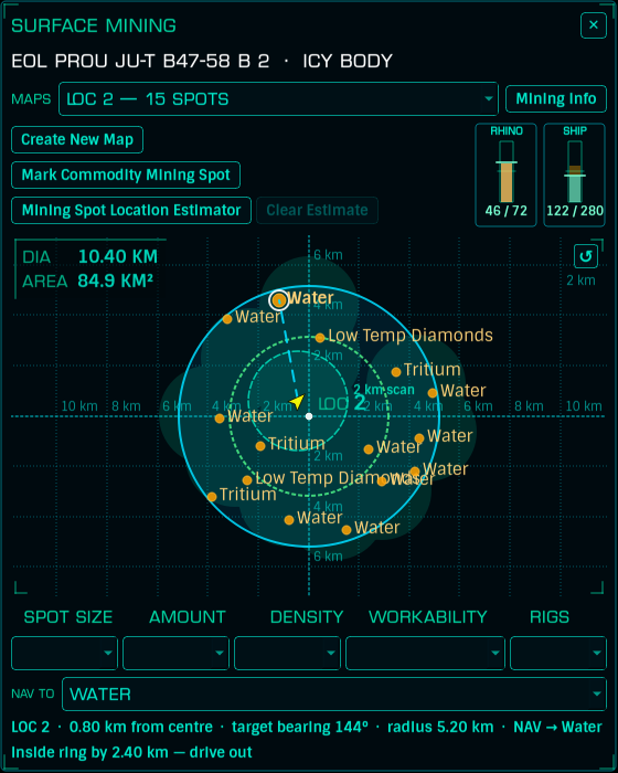
The Mining Helper is a standalone holo overlay for surface mining from the Rhino. It draws a live map of the planet under your feet: your position and heading, the SRV's 2 km scan ring, every mining location you've mapped, the scan areas you've driven over, and every commodity deposit you've marked - colour-coded by how good the deposit is.
It also keeps score: per-deposit harvest counts, and live RHINO and SHIP hold gauges so you don't overflow at the transfer.
Mining locations are the numbered signals Elite shows you; a map is your record of one.
LOC # from the prompts.The status line walks you through it ("Deploy Rhino → Set Centre, then Mark Edge at the boundary"), and the buttons tell you why they're refusing if they won't start ("Fly to a planet surface first", "Scan the planet (FSS/DSS) to reveal mining location numbers", and so on).
Once a map exists, the MAPS combo lists them ("LOC 2 - 15 spots"). Deploy the Rhino within 2 km of a saved centre and the right map loads itself.
Drive over a mining deposit and use Mark Commodity Mining Spot to record it. Fill in the spot's attributes as you read them off the game - size, amount, density, workability, rig count. Rows and map dots are then colour-coded the Elite way:
| Colour | Meaning |
|---|---|
| Green | Large / High / Great - prime |
| Amber | Small / Annoying |
| Sand | Tiny / Low |
| Red | Unworkable |
Spotted a deposit with the ship's panel but don't fancy driving over rough terrain to find it?
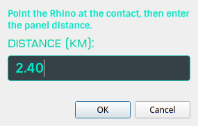
The overlay drops a magenta EST marker that distance away along your current heading, with a dashed ring, and sets NAV to it:
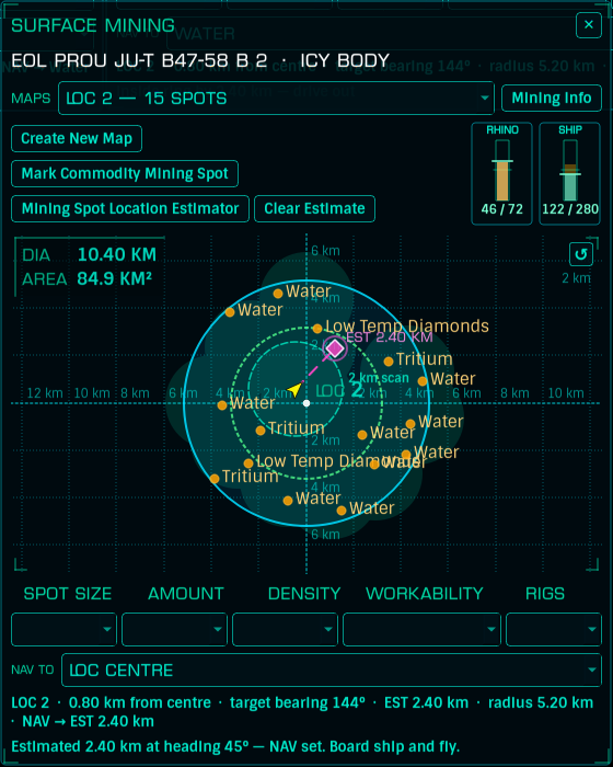
"Board ship and fly." Clear Estimate gets rid of it. Estimates are approximations by nature - your heading and the panel distance both have slop in them.
Every unit you refine feeds straight in from the game's journal: the overlay credits 1 t to the nearest matching deposit within 150 m. Deposits grow a "- N t mined" suffix in the NAV TO list, and the Info Browser's legend explains the mined/squeezed-dry counts.
The RHINO and SHIP gauges top-right show carried / capacity - the Rhino's refinery holds 72 t. A gold ghost bar shows where the level will land after a transfer, the frame flashes red on overflow, and a green +N t counts what you've refined this session. Warnings fire before you're stuck: "TRANSFER WILL OVERFLOW THE HOLD", "Hold nearly full", "Rhino refinery full". There's an optional system-tray notification for overflow in Configuration's Alerts tab.
The Mining Info button swaps the map for a data view of the body - handy from the Galaxy Browser without flying anywhere:
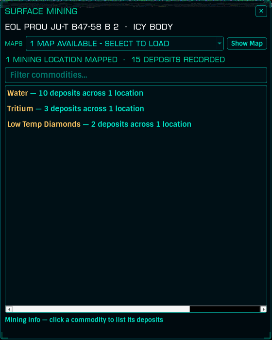
One row per commodity ("Water - 10 deposits across 1 location"), a filter box, and click-through to the deposit list:
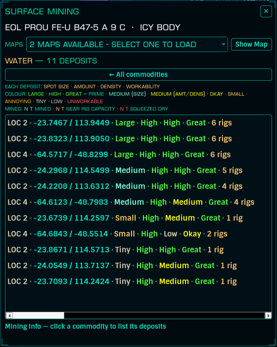
The drill-down lists every deposit best-first - coordinates, location, and all five attributes, colour-coded by quality, with rig counts. Show Map goes back.
Update your browser to view this website correctly.